Hiking cab "Höhenflug": From Birkenbrauck to Niedersalwey

#deinsauerland / Neusta Touren / Hiking cab "Höhenflug": From Birkenbrauck to Niedersalwey

Hike from the Birkenbrauck hiking parking lot via the Sauerland-Höhenflug to Niedersalwey.


2446632


2445978

Tour starting point:

Birbenbrauck hiking parking lot

Tour destination point:

Niedersalwey

Properties:

  • Family friendly

Additional Information

The hiking map of the Eslohe vacation region at a scale of 1:25,000 is available from the Eslohe Guest Information Office, Schultheißstraße 2!

Category

regionaler Wanderweg

Length

5.8 km

Duration

1:45 h

Elevation ascent

145 m

Elevation descent

313 m

Lowest point

339 m

Highest point

652 m

Condition

Difficulty

Recommended seasons

J F M A M J J A S O N D

A perfect starting point for the Sauerland-Höhenflug is the "Birkenbrauck" hiking parking lot. The hiking cab (Saturday & Sunday, only for holders of the Schmallenberg Sauerland Card) will take you there free of charge. Hike along the Sauerland-Höhenflug, accompanied by beautiful nature. The hiking cab starts at the bus station in the center of Eslohe, where parking spaces are available.

  • Start: Saturdays at 11.00 a.m. and Sundays at 10.00 a.m. at the bus station in Eslohe
  • Registration for the hiking cab: Please register with Taxi Fabri on 02973 / 81414 by 5 p.m. the day before at the latest. Please also register dogs.
  • Destination: The hiking cab will take you to the "Birkenbrauck" hiking parking lot. From there you hike back to Niedersalwey
  • For guests with Schmallenberg Sauerland Card: € 2 for adults, € 1 for children

Aussichtspunkt Homertgipfel


2446629

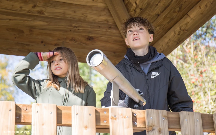
Breathtaking views are possible from the summit of the Homert.

Read More

Hiking portal Niedersalwey


2445978

Hiking map with seating in Niedersalwey

Read More

Hiking portal and Birkenbrauck hiking parking lot


2446632

Starting point for hikes along the Sauerland-Höhenflug and through the Homert.

Read More

0 km 1 km 2 km 3 km 4 km 5 km 400 m 500 m 600 m 700 m 342 655

Information

Directions

From the hiking parking lot, follow the yellow hiking sign for the Sauerland-Höhenflug (SHF) uphill. Take a short detour (follow the signs) to the highest point, the Homertspitze, and enjoy the wide view. Continue along the SHF until it bends to the left, where you walk straight ahead over the Eslohe Grenzgänger. At a fork in the path (small refuge), turn right onto hiking trail S4, which now leads (steeply in places) downhill towards Niedersalwey through spruce and Buchenwald. Enjoy the view of the beautiful Salwey valley.

Safety guidelines

Please wear sturdy shoes and take plenty of drinks with you!

Maps

Use the hiking map of the Eslohe vacation region at a scale of 1:25,000.

Public transit

For guests with a valid Schmallenberg Sauerland Card, bus travel on public transport is free of charge.


Timetable information for the hiking bus and information about the Schmallenberg Sauerland Card: www.sauerland-card.de


Timetable information for public transport: www.rlg-online.de

How to get there

This tour is ideal for guests from Niedersalwey. You do not need a car for this hiking suggestion.


The hiking cab (Saturday & Sunday, for holders of a valid Schmallenberg Sauerland Card) starts at the bus station in Eslohe and drives via the intermediate stops Niedersalwey and Obersalwey to the Birkenbrauck hiking parking lot.


For this hike, take the hiking cab in Niedersalwey. From Birkenbrauck you hike back to Niedersalwey in just under 6 km.

Parking

Leave your car at your accommodation in Niedersalwey and take the hiking cab to the Birkenbrauck hiking parking lot.

Interesting places in the neighbourhood

Wir binden die Videos der Plattform “YouTube” des Anbieters Google LLC, 1600 Amphitheatre Parkway, Mountain View, CA 94043, USA, ein. Datenschutzerklärung: https://www.google.com/policies/privacy/, Opt-Out: https://adssettings.google.com/authenticated.