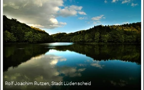
The Sauerland (as well as the neighboring Bergisches Land) has a very high density of reservoirs. The region is characterized by deeply incised, narrow valleys on the one hand and high levels of precipitation on the other. This meant that dams could be built and operated at moderate cost. Both industry and the population needed and still need large quantities of drinking and process water.
The Fuelbecke dam was built between 1894 and 1896 according to plans by Prof. Intze, the pioneer of German dam construction. It is one of the first dams with a quarry stone barrier. Between 1988 and 1991, the wall was renovated to the latest technical standards. The water catchment area is 4.7 km² in size and has an average annual inflow of 3.75 million m³.
The Fuelbecke is basically a "two-valley dam", with a wall separating the valleys of the Fuelbecke and Riethahner Bach watercourses, which converge at this point. This means that the dam has two arms, which are commonly called the "Lüdenscheider Arm" (the western arm, which is fed by the Riethahner Bach) and the "Rosmarter Arm" (eastern valley, Fuelbecke). In the map on the left, the forebay basin in the Rosmarter Arm is clearly visible in addition to the basic shape.
The circular hiking trail around the dam is suitable for many leisure activities. The trail is easily accessible from a hiking parking lot and is also suitable for strollers. Along the way you will find numerous information boards about the fish stocking in the local waters.